
Brooklyn Marine Terminal

122 acre waterfront redevelopment

📅 Coming up

Advisory Task Force office hours

Open virtual sessions run by EDC. Both are on Zoom, no registration page, join at the time.

11
Aug
Office Hours #1
12:00–2:00pm · Virtual
Join ↗
20
Aug
Office Hours #2
12:00–2:00pm · Virtual
Join ↗
Subscribe to updates ↗ Past sessions and materials ↗
Listed by NYCEDC as of 10 August 2026.
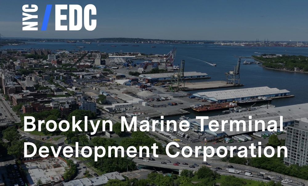
Brooklyn Marine Terminal Development Corporation
Brooklyn Marine Terminal Development Corporation EDC ↗
⚡ Where it stands

Environmental review, ahead of a state adoption

The Draft Scope of Work comment period closed on May 8, 2026. A Final Scope of Work follows, listing every comment and how it will be handled in the Environmental Impact Statement.

The city's Office of the Deputy Mayor for Housing, Economic Development and Workforce is the lead agency for review. Once the draft EIS is published, Empire State Development adopts a General Project Plan. The project is proceeding under the State's process rather than the city's ULURP.

The Advisory Task Force continues to meet, and EDC is holding public information sessions on site plan updates. EDC aims to release the first request for proposals for a long term port operator by the end of 2026.

Meetings and sessions at EDC ↗ The state's project page ↗
What is actually proposed
A 60 acre all electric port, 6,000 homes of which roughly 2,400 permanently affordable, 275,000 square feet of light industrial space, 250,000 square feet of community facility space, 275,000 square feet of commercial space, a 400 key hotel, and 28 acres of new open space, across 122 acres from Atlantic Avenue to Red Hook. Roughly $3.5 billion, built out into the late 2030s.
The port question
EDC asked port operators and maritime businesses how the site could work as a working port, through a Request for Expressions of Interest issued in December 2025. 25 responses came back. EDC has said the environmental review may include a port first alternative for comparison, but that it continues to advance the Vision Plan as approved. The first request for proposals for a long term port operator is expected by the end of 2026.

Brooklyn Marine Terminal Vision Plan

Full Vision Plan PDF ↗

The Brooklyn Marine Terminal (BMT) is a 165-acre former port site on the Red Hook waterfront, transferred from the Port Authority to NYCEDC in May 2024. The NYCEDC BMT Vision Plan, completed September 2025, charts a transformation into a modern all-electric port alongside new housing, open space, and community amenities — ending 50 years of disinvestment on the CB6 waterfront.

⚓ 60-acre modern port 🌳 28 acres public open space 🏗 Up to 6,000 housing units 2,400 permanently affordable (40%) Data: NYCEDC · Task Force 2024–25
Vision Plan Zone Map

Four planning zones overlaid on the BMT site boundary. Zones reflect the September 2025 Vision Plan.

Planning Zones at a Glance
Container & Flex Terminal
~71 ac · Central port zone
New 60-acre all-electric marginal pier replaces dilapidated Piers 7–10. Handles containers, perishables, cruise, and Blue Highways barge service. Federally funded ($164M USDOT MEGA grant + $109M City match).
Atlantic Basin District
~52 ac · Western waterfront
BCT, Pier 12, and Pier 11 uplands. Planned for 2,200 housing units (880 affordable), modernized Brooklyn Cruise Terminal, up to 400 hotel keys, 220K sf industrial, 200K sf commercial, and 11 acres of public open space.
BMT North
~34 ac · SE mixed-use district
Atlantic Ave (N) to Degraw St (S), Columbia St (E) to new neighborhood street (W). 3,800 housing units (1,520 affordable), new public school, 17 acres open space, 55K sf light industrial, 75K sf commercial.
Open Space & Greenway
~34 ac · Eastern waterfront strip
Nearly one mile of greenway connecting Brooklyn Bridge Park to the Atlantic Basin. Pier 7 destination park, neighborhood parks, and 5,000+ linear feet of new public waterfront access.
Key Commitments
$418M
Public funding committed
6,000
Housing units (max)
2,400
Permanently affordable units
$200M
NYCHA Red Hook investment
$75M
Off-site affordable housing fund
28 ac
Public open space (min)
275K sf
Light-industrial space
$18B+
Economic impact projected
Process & Next Steps
BMTDC Formation
Brooklyn Marine Terminal Development Corporation created within 6 weeks of Vision Plan vote to implement commitments and oversee GPP process.
Empire State Development GPP
The Vision Plan feeds into ESD's General Project Plan (GPP) process, which includes environmental review and Public Authorities Control Board final approval.
Phase 1 (through 2030)
Simultaneous start of marginal pier construction, 170K sf Pier 11 industrial building, and BMT North housing. Port operator RFP to be released post-GPP.
Task Force
28-member Task Force chaired by Rep. Dan Goldman, co-chaired by Council Member Avilés and State Senator Gounardes. CB6 Board Member Mike Racioppo served as Task Force member.
Data sources: NYC Economic Development Corporation (NYCEDC) · BMT Vision Plan, September 2025 · edc.nyc/bmt ↗ · Felt map by CB6 · Zone boundaries approximate per Vision Plan
📁 BMT Document Library

All CB6 BMT materials organized by category. Tap any folder to expand and access documents.
Share or Embed This Page

Copy the direct link to share, or use the embed code to display this page on your own site.

Know your rights as a tenant Repairs, heat and hot water, harassment, eviction, lease renewals and rent regulation. From HPD.
Tenants’ rights →